Coastline Matching Algorithm
Step 1 - preprocessing
[ Main |
Previous: Overview |
Next: Step 2 - chain code ]
The preprocessing contains the following steps.
We start from scanned maps. Later this can be extended to satellite images.
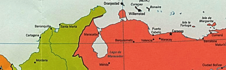 The color channels are decomposed, but instead of RGB, CMY is used. From the
components we use the yellow channel, beacuse it is easy to detect sea,
which is blue, so having only a little yellow component.
The color channels are decomposed, but instead of RGB, CMY is used. From the
components we use the yellow channel, beacuse it is easy to detect sea,
which is blue, so having only a little yellow component.

In the last step the coastline is detected, using the following algorithms:
- Box filtering
- Robert's gradient
- Tresholding
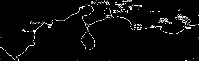
- To create the yellow component the GIMP program was used.
- The edge detection was done by a small program written by Robert Vanyi
[ Main |
Previous: Overview |
Next: Step 2 - chain code ]