Jelenlegi hely
Geoinformatics
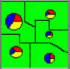 An agricultural statistical system has been elaborated, the first really significant GIS system of the Hungarian Central Statistical Office. The first version manages the data of vineyard and fruit cadastre.
|
 Scanned cadastral maps have been vectorized, and map objects have been recognized using graph algorithms and neural network.
|
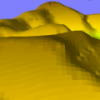 The well-known thin plate spline interpolation method has been adopted and improved to produce a digital elevation model (DEM) covering the whole territory of Hungary.
|